Hancock County (Georgia) Cemeteries
Cemetery details
Harris Cemetery


Location:
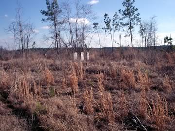
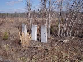
From the Hancock County Courthouse, go northwest on Hwy 16 for 6.8 miles to Hunt's Chapel Rd on the left. Turn left on Hunt's Chapel and go for 0.7 mile to the intersection of Hunt's Chapel and Dickens Pond Rd. Park. Continue straight ahead (south) on the now-closed Hunt’s Chapel Rd. and walk approximately 0.5 mile south of the intersection. Take the left fork of a logging road. Go 0.1 mile (500) feet southeast to the cemetery; or continue straight and go another 0.1 mile, turn left (east) and go 400 feet to the cemetery. The three upright white marble Veterans Administration markers are placed in a line.
From the Hancock County Courthouse, go northwest on Hwy 16 for 6.8 miles to Hunt's Chapel Rd on the left. Turn left on Hunt's Chapel and go for 0.7 mile to the intersection of Hunt's Chapel and Dickens Pond Rd. Park. Continue straight ahead (south) on the now-closed Hunt’s Chapel Rd. and walk approximately 0.5 mile south of the intersection. Take the left fork of a logging road. Go 0.1 mile (500) feet southeast to the cemetery; or continue straight and go another 0.1 mile, turn left (east) and go 400 feet to the cemetery. The three upright white marble Veterans Administration markers are placed in a line.
GPS coordinates: 33 18' 51.3" N 83 04' 10.0" W
or in degrees only form: 33.31425° N X 83.06944° W
See location on a Google map in a new window (NOTE:The map opens in a new window. The cemetery will be at the location indicated by a red marker.)
GMD: 102
Cemetery Status: Inactive
Predominant race: White
Surrounded by a field stone boundary, measuring 10 by 10 feet square. Entire area clear cut (2002) and planted in pines.
Indexer or Contributor: Rick Joslyn
Absalom Harris
- Nov 19, 1824
Marker placed in 1930s by DAR.
Military Service: American Revolution
Virginia 2 Lieut.
Click for more info.
Military Service: American Revolution
Virginia 2 Lieut.
Click for more info.
Grave 1
Benjamin Harris
- 1812
Marker placed in 1930s by DAR. Marker probably in error. Marker is for a different Benjamin Harris not buried here.
Military Service: American Revolution
Lieut 2 Va Troops
Click for more info.
Military Service: American Revolution
Lieut 2 Va Troops
Click for more info.
Grave 2
Joseph Jeter
Marker placed in 1930s by DAR.
Military Service: American Revolution
Virginia, Ga Troops.
[Ga Troops inscribed in error.]
Click for more info.
Military Service: American Revolution
Virginia, Ga Troops.
[Ga Troops inscribed in error.]
Click for more info.
Grave 3